
I’m constantly in awe of the North Cascades. This feeling is often reflected in my writing about these mountains; I tend to go wild with superlatives. When researching Shuksan, it’s clear that it inspires similarly descriptive writing from other climbers. Beautiful. Massive. Jaw dropping. Rugged. Classic. I’ve heard all of these words and more used to describe Mt Shuksan, and they all fit the bill. I finally visited this stunner of a mountain and climbed the Fisher Chimneys/SE Ridge route to the summit on August 10, 2024 alongside Larissa Ault, Anna Canfield and Raaj Ruparel.

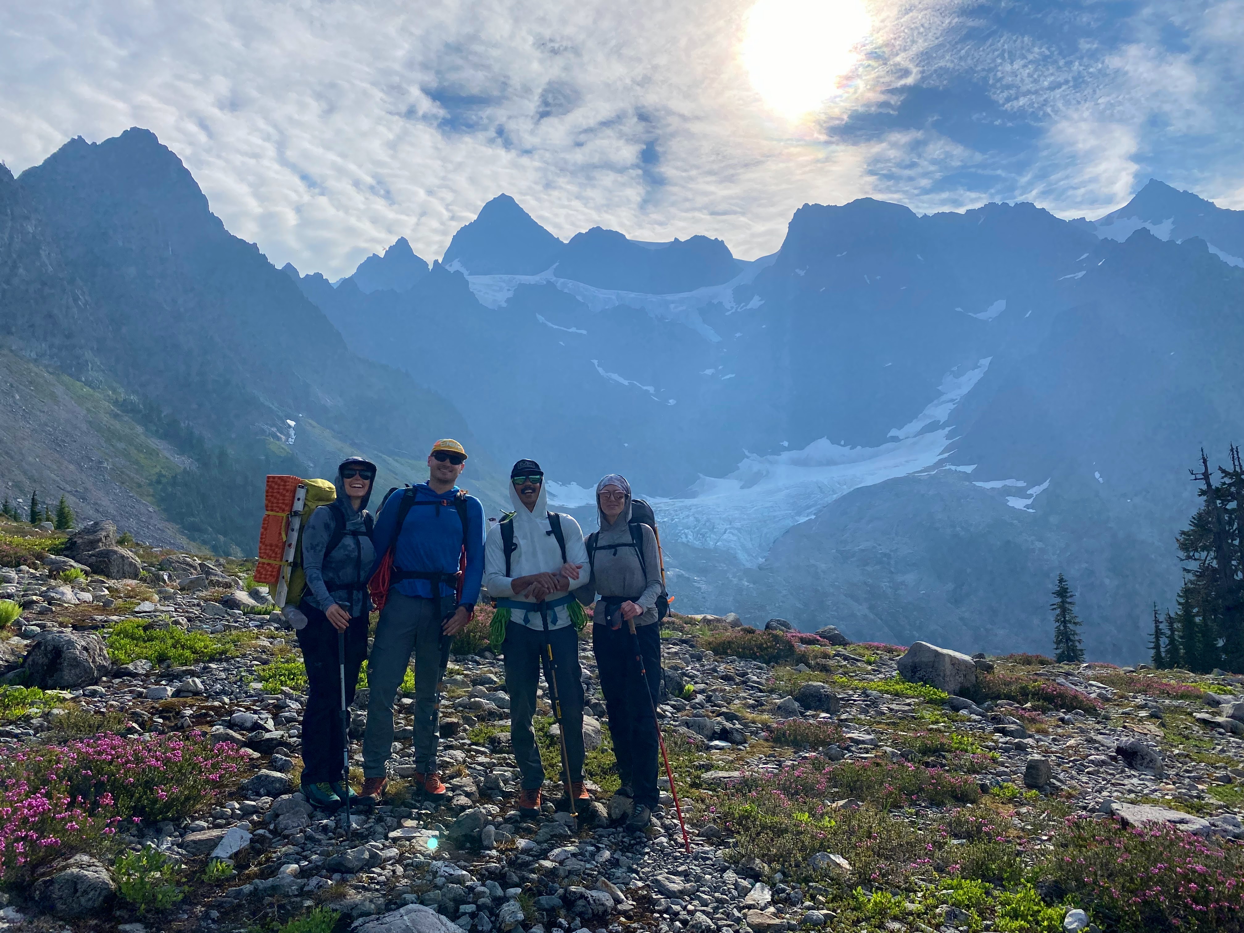
Given the long commute from Spokane, we opted for a three-day leisure schedule for this climb. Larissa and I got up early and blasted the eight hour drive to meet Raaj and Anna at the trailhead by early afternoon. The hike to camp at Lake Ann took only a couple of hours and gave us all time to catch up – time in the mountains with friends is a treat.

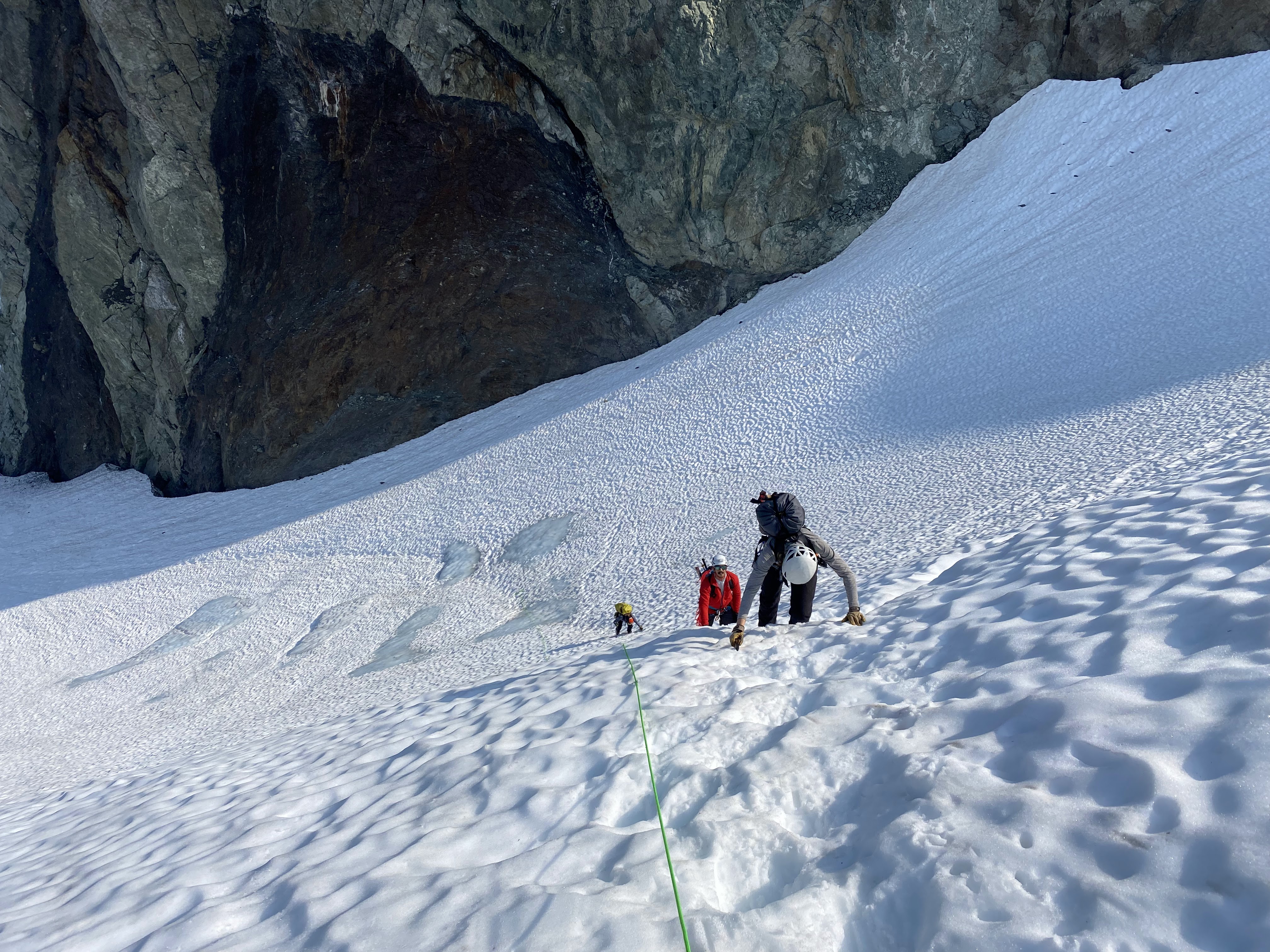
After a predawn start, we arrived at the base of the Fisher Chimneys where we made a routefinding error. The classical Fisher Chimneys route exits the scree field on a mellow traverse rightward on an obvious trail. This was invisible to us in the dark (and we didn’t look very hard), so we went straight up into the wrong “chimney.” Eventually things got steep enough that we were forced to traverse right into another gully which was somewhat easier but still exposed fourth class. Around this point I realized we were in the wrong spot, but it seemed like things would work out if we kept forging upward. Eventually we crested the top of Shuksan Arm where I could see the bootpack across snow several hundred feet right of our position. Oops! We had taken a harder route than needed, but that was behind us now. Back on track, we roped up and traversed the tip top of the White Salmon Glacier and ascended Winnie’s Slide, which was snow-covered and mellow. After crossing over a rock barrier, we stepped onto the upper Curtis Glacier which we had been gawking at the day before.


Traversing the upper Curtis glacier was straightforward but involved a series of ups and downs, along with a spicy section of crevasse navigation in the middle. Soon we reached the bottom of Hell’s Highway, a fairly steep snow and ice slope that would allow us to climb onto the Sulphide Glacier. There were patches of blue ice starting to show and the lower part of the pitch had 2-3 inches of snow over ice, but we all ascended this section without a belay.

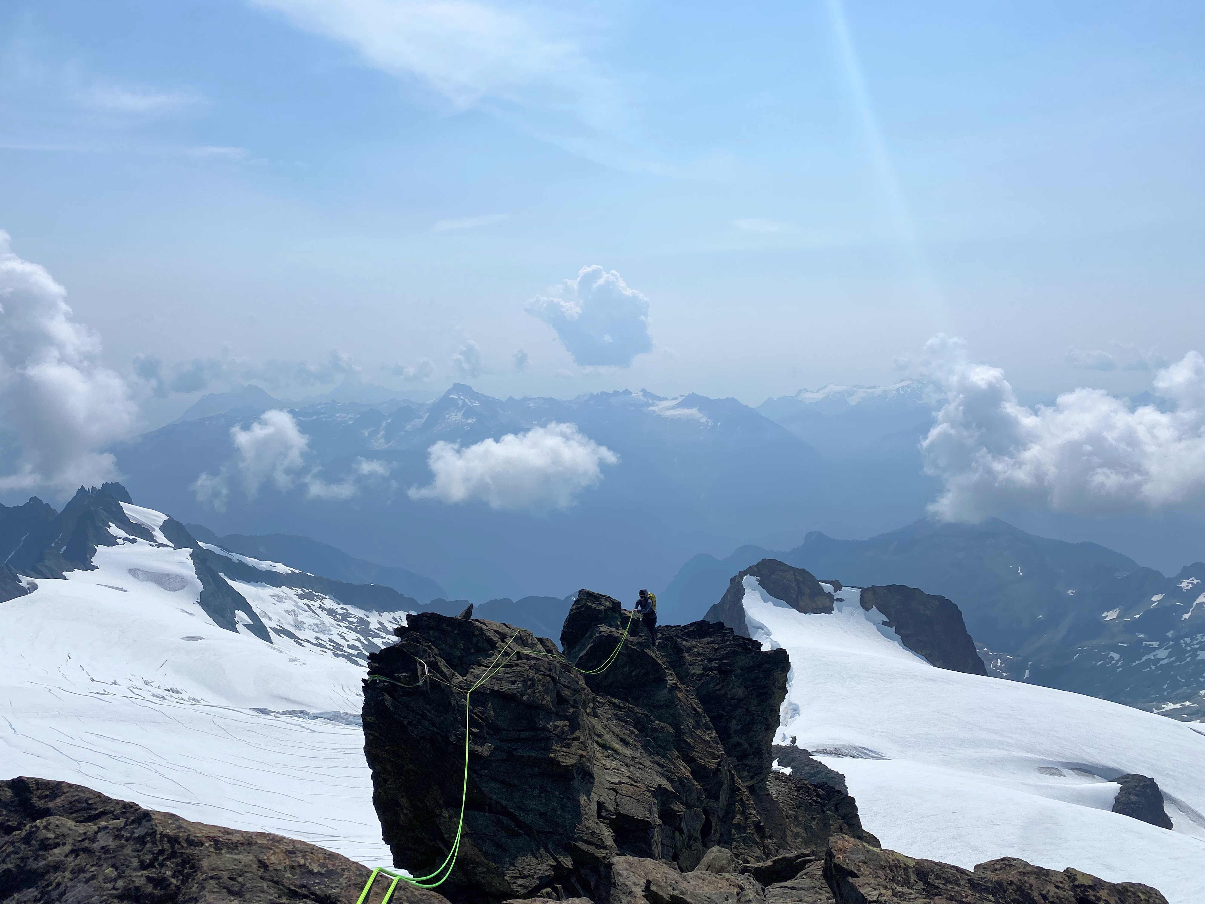
With the summit pyramid tantalizingly close, we churned up the upper reaches of the Sulphide Glacier and gained the Southeast Ridge at a prominent notch. Splitting into two teams, I led out onto the ridge with Larissa following behind. Raaj and Anna were hot on our tails as we cruised up the ridge. With some short stretches of simulclimbing, we reached the summit in six pitches. The rock on this ridge is extremely well featured which made climbing in boots feel easy, though protection is pretty limited. Using terrain features for protection and belays is a key skill here. There is one slabby, exposed move that will get your heart pumping.

As we hit the summit, the swirling clouds around us began to gain energy quickly. Distant rumbles of thunder underscored the need to get down quickly so we got to work. A couple of rappels and some downclimbing brought us down the South Gully before we switched back into glacier travel mode and worked through a whiteout on the Sulphide. Once we reached the top of Hell’s Highway, we were back in calm, clear air and breathed a bit easier now that our risk of being struck by lightning was greatly minimized. I equalized a couple of pickets for everyone else to rappel off of before I removed them and downclimbed Hell’s Highway with two tools. The rest of the way down was uneventful, especially because we descended the correct “Chimney” on the way down. We did a few rappels in the Chimneys but mostly downclimbed. It was really funny to see the well-worn trail that we could have cruised up that morning if we’d made better routefinding choices.


Strategy Notes
This climb easily goes in a day (or even a morning) for experienced, fit teams. Others will be happy to climb on a two or three day schedule. The bivy sites near Winnie’s slide are spectacular, though permits are required.
Gear Notes
Footwear is a bit of a conundrum for a route this varied. I wore La Sportiva Trango Cube boots (3/4 shank mountaineering boots) for our entire summit day while everyone else brought along both approach shoes and boots. A 60m twin rope is a great choice for this route, which you can fold in half for the rock climbing portions. I brought cams .4-1 and four midsize offset nuts for the SE Ridge, though just about any rack would work. A lot of the protection for the SE Ridge comes in the form of terrain belays and slung horns.

Many years ago Michael Toner, John Hutchinson, and I tried the White Salmon Glacier route. But after a couple hours on that we realized it would not work (too much bushwhacking, and maybe some other problems I can’t remember). So we camped somewhere near the Lake Ann TH and did the Fisher Chimney route from TH to TH in a push the following day. That was a memorable day — so I guess this must be common now, since you say it goes “easily” in a day.
LikeLike
Hi Stan – yes, I have good friends who have blasted TH to TH in 12 hours! I’d like to go back for a fast ascent of Fisher Chimneys one of these years, and I’d also love to ski the White Salmon glacier.
LikeLike