
Kyle Tarry and I attempted Sunset Ridge on Mt Rainier on June 14-15, 2025. I typically don’t like to write about attempts, but there is almost no information on this route online. The reports that are available are not recent. I decided to write up this attempt to give info to future suitors and show off some sweet photos. Enjoy and please let me know if you head up there!
Mount Rainier is a treasure of the Cascades. Incredibly rugged, plastered with glaciers and rock, providing true big mountain terrain and challenges. I’ve climbed several routes on Rainier over the years, and every experience has been as rewarding and beautiful as they’ve been humbling. It’s hard up there! Kyle and I had our springtime Alaska Range plans fall through, so we both had a thirst for an icy adventure. We settled on Sunset Ridge, a lesser-known route on the remote West side of Mount Rainier.

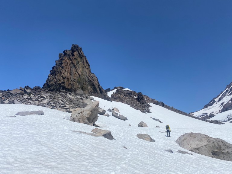
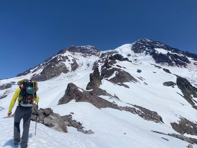
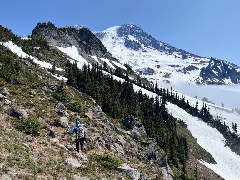
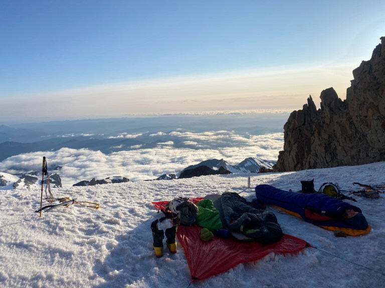
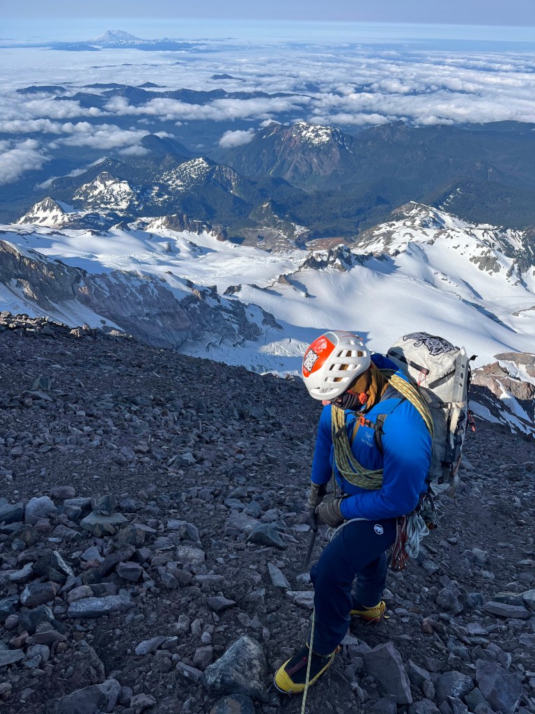
Our long approach began with a road walk and maintained trails before fading to off-trail scree and snow travel on a major ridge. I had never seen the Western aspect of Rainier before and the views were spectacular. Eventually we roped up, dropped off of the ridge and crossed the Puyallup Glacier. Once across the glacier, we crested Colonnade Ridge which is a good place to camp (snow), but I convinced Kyle to keep pushing upward to another good spot at 9600 feet to shorten our summit day. To reach 9600 camp, we now had to run a gauntlet of objective hazard. First came a traverse under the Sunset Ampitheater icefall. The only hazard here would be the biggest of serac avalanches, but it’s clear to see that these are possible. Next was a rock buttress that had littered the area below with an impressive amount of rockfall debris. Kyle suggested that we jog through that section which I enthusiastically agreed to. The final leg of the approach involves climbing up the South Mowich Glacier to camp. This area is threatened by rockfall as well so keep your head on a swivel! Thankfully the crevasses were easy to read.
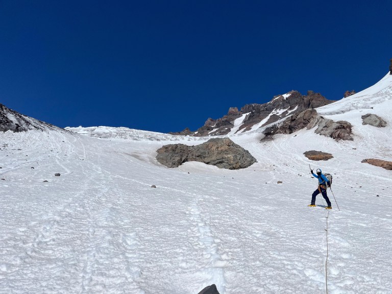
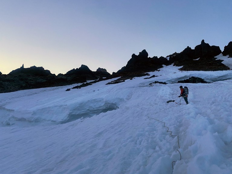
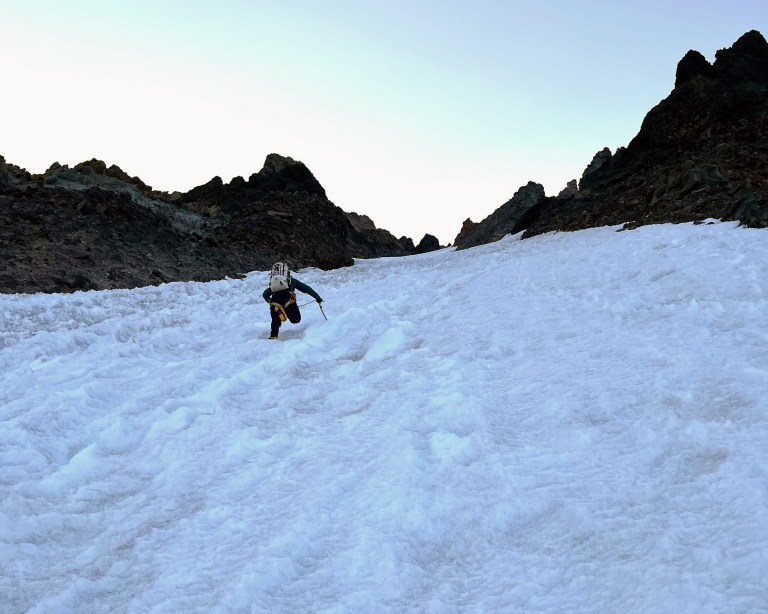
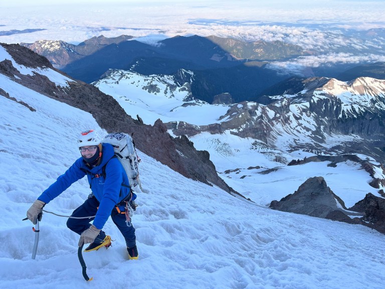
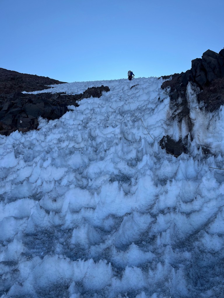
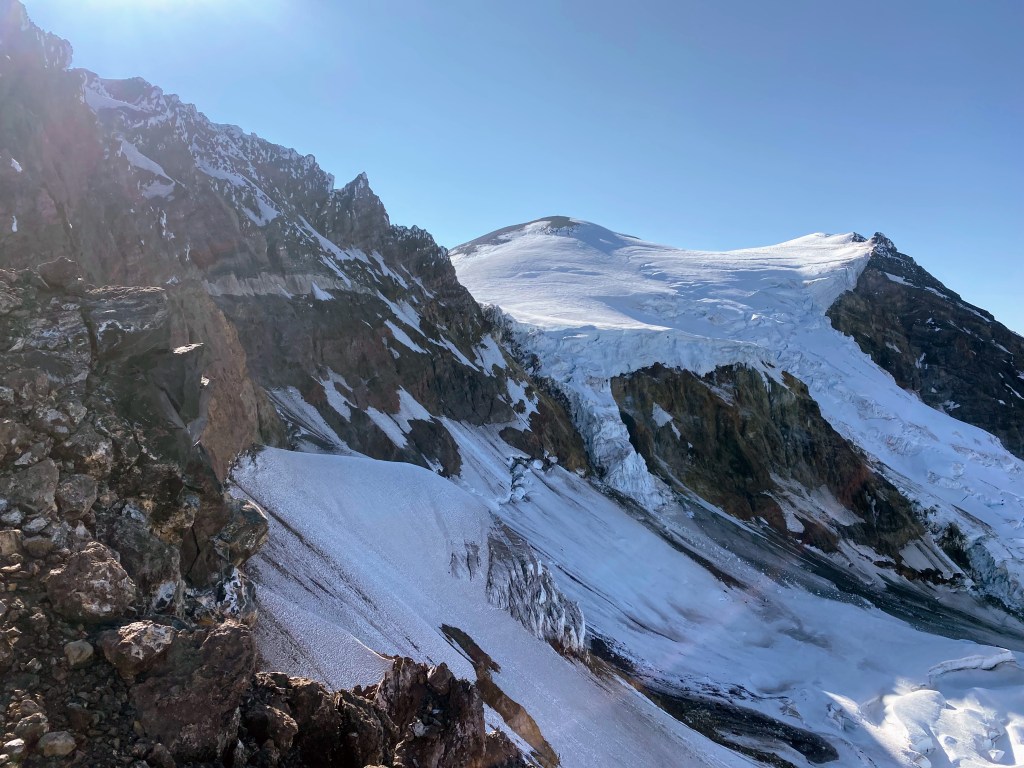
From our bivy, we made a short traverse across the glacier to investigate the bergschrund crossing. From the approach, the ‘schrund had looked borderline impassible, but we found a good spot on climber’s right. Kyle belayed me as I led the bergschrund which was quite easy with two ice axes. It seemed that this would soon melt out/collapse and make things much harder. Above the bergschrund, we stowed the rope and cruised up a 2000 foot couloir of neve averaging 45 degrees in steepness.
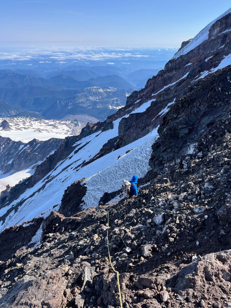
The top of the couloir gifted us with some easy ice climbing which carried us to the rocky ridge crest. We chose to rope up before we hit the ridge crest, unsure of how exposed things would be. There was a section of fourth class choss traversing right along the ridge crest, then the ridge broadened to the point where we were walking. The rock here was truly horrific; I didn’t touch a single solid piece of rock here. The ridge itself is a pile of loose rock. With no snow covering the choss, this was slow and somewhat dangerous going.
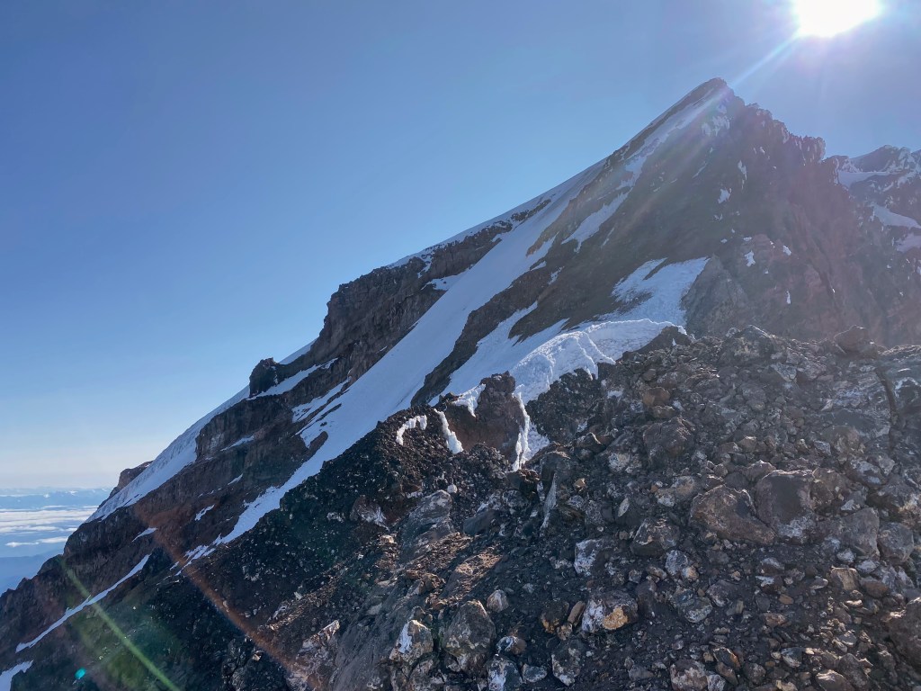
At this point, the route traverses left off of the sharp ridge crest to access the upper Mowich Face. We found a knife-edge section of ridge split by a deep gully and notch blocking our progress. This has been a very dry season on Mt Rainier, and the gully had almost no snow to ease the transition off of a steep choss wall into the gully. With only a 30 meter rope, our options were limited and extremely risky. Some past trip reports mention belaying this section with no protection other than your belayer sitting astride the ridge – even this wouldn’t be possible for us with our short rope. We were in a tough spot but the choice was clear: we need to bail down the route.
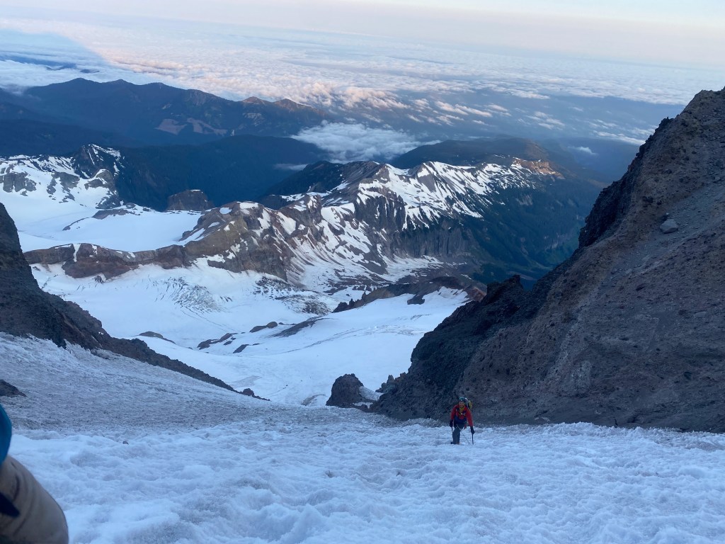
After downclimbing the ridge to the top of the couloir, we downclimbed as fast as we could. Things were going well at first but they took a turn when multiple pieces of rockfall landed between Kyle and I. A short time later, I took a bad hit to my left hip that forced me to dive into a self arrest position, fearing that I’d be knocked off the mountain. Lower down, we had another couple of close calls with rockfall. Risky business! Once we crossed the bergschrund, we took a short break before undertaking the long slog to the cars.
Gear Notes
If I tried this route again, I’d bring a 60m rope along with some long slings and 4-6 ice screws for the upper Mowich Face. I’m not convinced that rock gear could be used.
Strategy Notes
This route should only be attempted during good snow years. With climate change, these will be increasingly harder to come by.

We turned around in the exact same spot on June 10th 2025, crappy rock and no snow to make the transition to the mowich face.
LikeLiked by 1 person